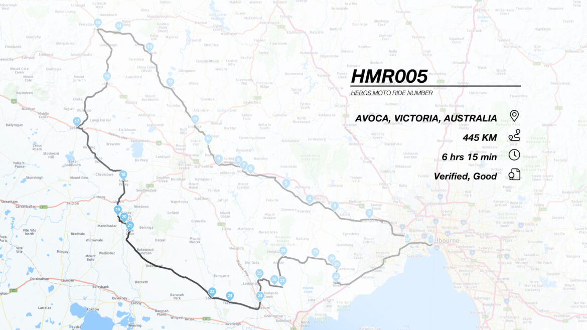
Yes, another day ride to lunch over 445km of hill, dale and countryside, through Western Victoria, Australia.
WHERE TO?
This ride takes you firstly in a north westerly direction, through the gold rush towns of Gordon, Creswick and Clunes before heading south west at Avoca, through the western plains, back toward Melbourne.
An online version of the route map may be found here: https://www.myrouteapp.com/en/social/route/4036200?mode=share
POINTS 1 TO 4 – MELBOURNE TO BACCHUS MARSH
From the Start Point at the Westgate Bridge, continue outbound over the bridge and onto the Westgate Freeway. Take the left merge onto the Western Ring Road and continue on it until you get to the Western Freeway turn off, which is 1.5 km past the Mobil Service Centre at West Sunshine. Be careful of the fixed speed camera about 1 km before the Service Centre!
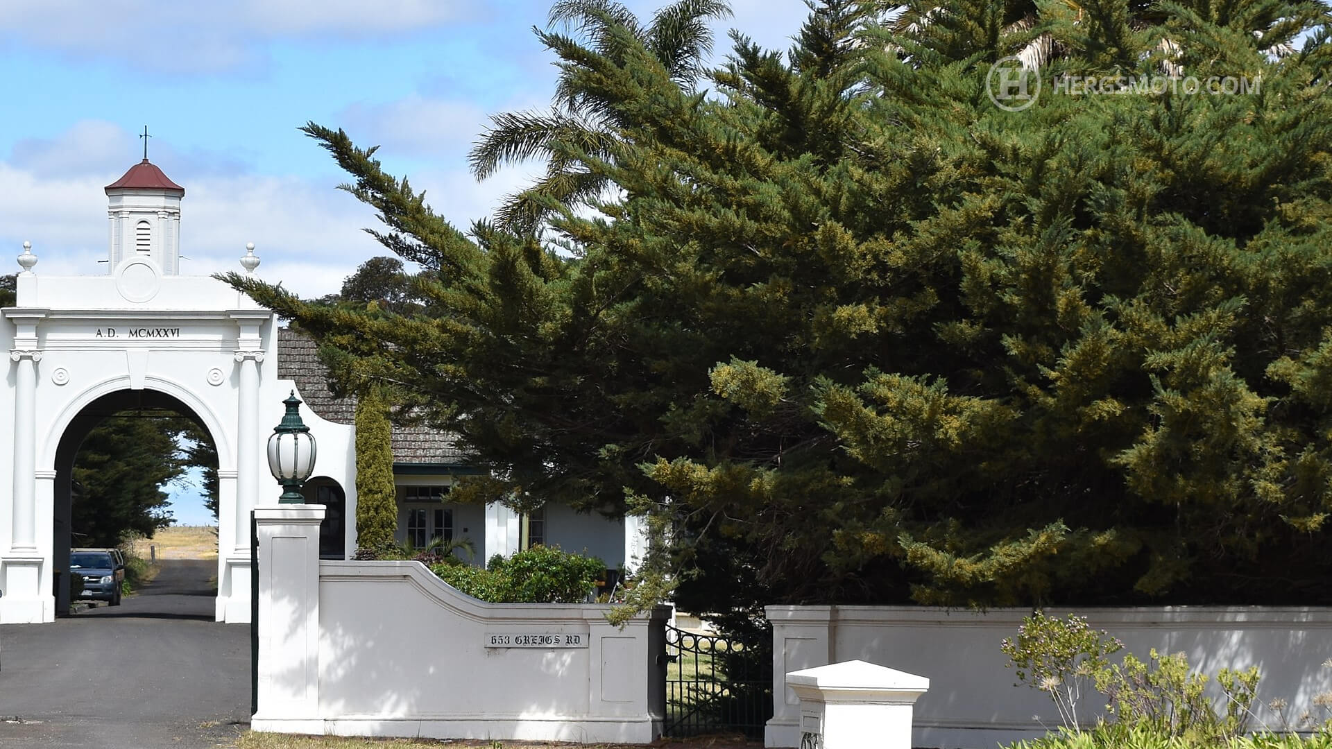
Continue on the Western Freeway, until you get to the Hopkins Road exit, where you exit left onto Hopkins Road. Head towards Werribee, cross the railway line and take the first right onto Greig’s Road, moving toward Point 2. When you pass the T-junction with Leakes Road, you may notice a collection of “Mission Revival” styled buildings on your left. This is the site of the old Beam Wireless Radio Receiving Station, which first connected Australia to England via wireless in the 1920’s.
It’s Transmitting Station counterpart, was located in Fiskville, near Ballan and it later became the CFA Training School.
Follow Greig’s Road, including the dog leg onto Mt. Cotrell Road, which gets you onto Greig’s Road West. Continue on this road, past the Melton Weir and it becomes Exford Road. Look out for the Parwan Road turn off, and turn right into it, heading toward Point 3. Heading to the intersection (and new roundabout) with the Bacchus Marsh-Geelong Road, you’ll turn right to Bacchus Marsh.
Once in Bacchus Marsh, you cross the railway line and take the first left into Griffiths Street, which you follow to the second roundabout where you take the second exit into McCormacks Road. This road climbs into the hills, and you reach Point 4 by turning right onto Ironbark Road, immediately after crossing over the railway line via the bridge.
POINTS 5 TO 9 – INGLISTON TO BUNGAREE
Ironbark Road, meanders up to the plain at the top of the hills, following the railway line to Ballarat. It has been recently sealed for its entire length and is generally good in condition. You have a couple of enjoyable downhill hairpins, as you travel under the railway bridge at Ingliston at Point 5. The road is rather narrow here, so watch out for oncoming traffic. The road brings you out on the Melbourne Road in Ballan, where you turn left into the centre of Ballan.
Ballan itself has a few good cafes and a very good bakery that dispenses delicious comestibles.
The TinPlate Cafe or the Zest Licensed Cafe and The Ballan Bakery.
From Ballan, we continue westwards crossing the Ballan-Geelong Road to stay on Old Melbourne Road (Point 6) to the rustic village of Gordon at Point 7. In addition to a rather good pub and general store, there is also a hatter and bookmaker located here.
At Gordon, take the right turn to the Freeway and continue on until you get to the Ballarat bound Freeway onramp. Take this ramp, but do not get onto the Freeway. Instead, turn left onto the eponymously named Butter Factory Road. Follow this road through the farmland and it brings you to the Wallace Butter factory and the associated small township. Turn left onto the Bungaree-Wallace Road and ride it to Bungaree, which is Point 9.
POINTS 10-15 – BUNGAREE TO AVOCA
Next we turn right onto the signposted road to Creswick in Bungaree at the football oval. This road is a favourite of mine. It rolls along the hills and farmland and then through some forest near the Creswick end. It also is in good condition and has some interesting sweepers along its length. Be a bit careful of the roundabout with the Midland Highway at Pootilla, (Point 10) which can cause a bit of a surprise! The road from here follows the contour lines of the hills, which results in an entertaining ride. Keep a look out for our native fauna, as the forest tree line does get a bit close to the road at times, giving you little to no warning of kamikaze kangas or koalas.
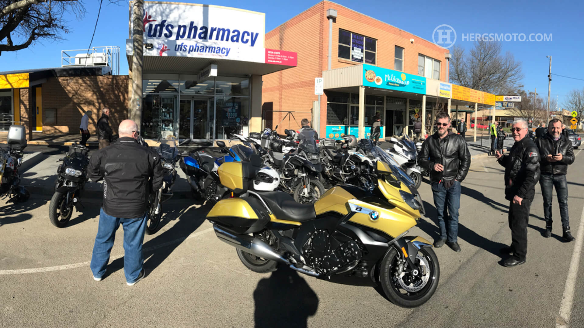
Creswick at point 11, has a range of cafes, pubs and bakeries to suit most palates including some of these:
Smokeytown Cafe and Restaurant
Heading through the town of Creswick, we stay on the C291, the Creswick-Clunes Road towards Clunes which is point 12 on our route.
Clunes is the site of the first gold discovery in Victoria and many of the buildings in the main street reflect this heritage. Clunes delights in calling itself “Booktown”, a sobriquet it has earned by the number of second hand bookshops that are located within the town. Clunes has another claim to fame, namely appearing in the first Mad Max film, which is an international classic Australian dystopian action thriller. It features as the town the bikies took over when they collected the Toe Cutter and his coffin from the Railway Station. The surrounding area was also used in various scenes in the film.
There are a number of cafe’s in Clunes and the bakery is worth sampling. A list of eateries in Clunes is here: https://clunes.org/eat
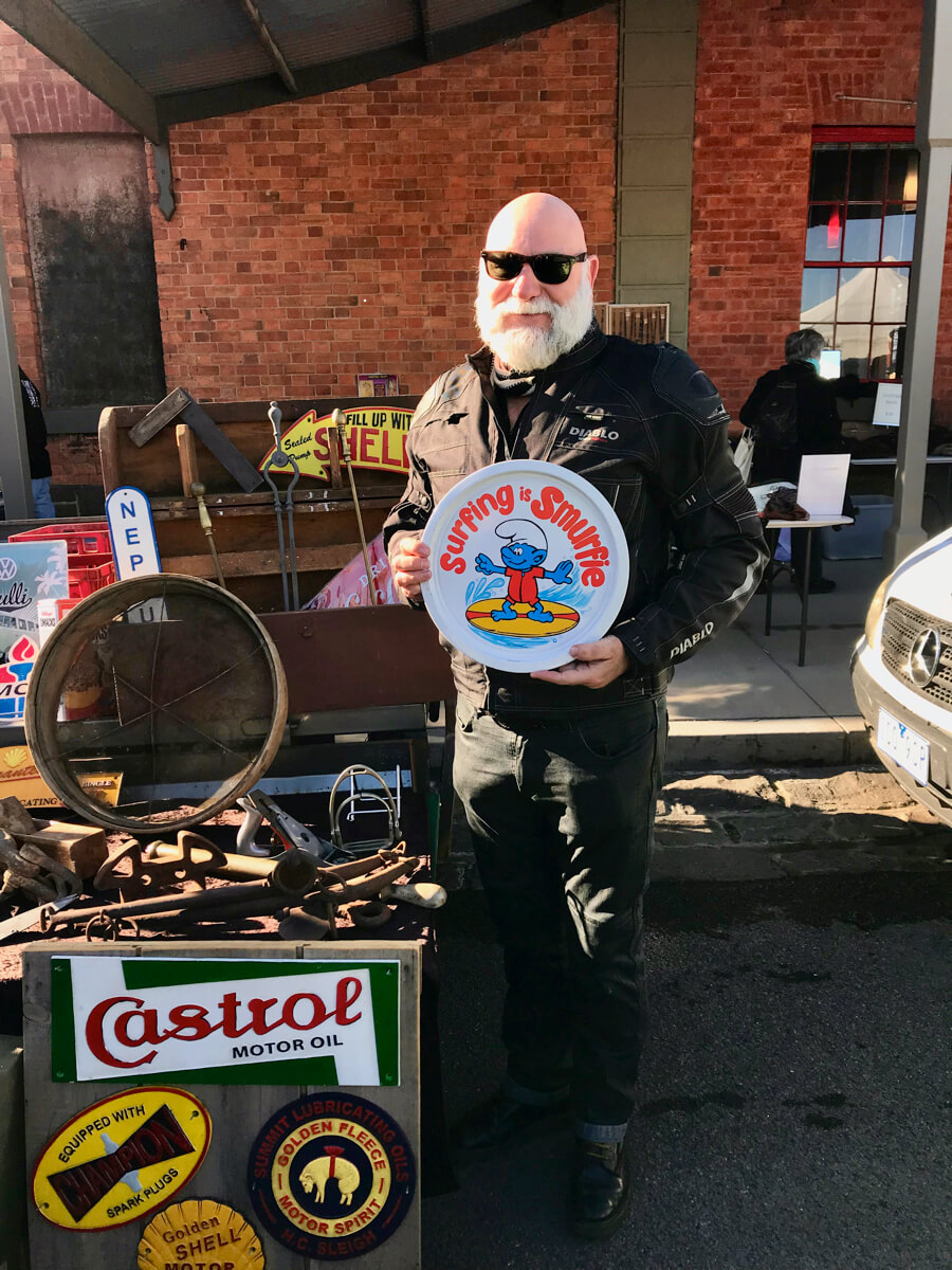
From Clunes, we continue along the Ballarat-Maryborough Road (C287), heading toward Talbot, which is Point 13. The C287 runs along the outskirts of Talbot, but if Farmers Markets are your thing, then the one that is held on the third Sunday of each month is well worth pulling into the town. It spreads itself over several streets in the town and also has some excellent food stalls.
Turn left at the turn off to Avoca/Beaufort, which is the C172. This road is rather narrow, but twists gently through the forest and scrub through the locale of Amherst, which is Point 14. It then joins the Pyrenees Highway, where we turn left towards Avoca and Point 15.
Avoca is a major stop on the Sunraysia Highway, which links Melbourne to Mildura. Pyrenees Pies is a great place for a pie – and they do have some rather exotic varieties including crocodile. Another good choice is the Home Made Cafe.
We then travel south along the Sunraysia Highway, until we get to the small town of Lexton (Point 16), where we turn left and rejoin the C172 again. Except it is now named the Beaufort-Lexton Road, which although rough in parts is a very good road to ride.
Actually, herewith some video evidence of three of the roads that are travelled as part of this ride, complete with some rather dubious music.
At the end of this road we come into Beaufort, (Point 17) which is a good place to refuel. Beaufort also has a very good range of places to eat, drink and sleep should you desire and here are some for your consideration:
The Skinny Sisters Cafe and The Pyrenees Pantry.
The Home Made Cafe mentioned above also has a cafe in Beaufort.
From Beaufort, we head east along the Western Hwy for a couple of kilometres. We turn right onto the Beaufort-Carngham road and ride towards the hamlet of Snake Valley. This road wends its way through pasture and farmland with good lines of sight. Snake Valley (point 18) and Linton are both small towns, with good pubs, shops and cafes to wile away an hour or two.
We ride south along the Linton-Naringhil Road until we get to the Happy Valley Crossing Road at Point 19. Here we turn right and make our way on the narrow and winding road through Happy Valley (Point 20) and onto Cape Clear.
The pub at Cape Clear (Point 21) is sadly still closed, but the light house is still there!
We now start to make our way back to Melbourne, through the Western Plains, going through Rosewood, Shelford (Point 22) and Teesdale (Point 23). The Teesdale General Store is a good stop and is surprisingly busy for a store in such a small town!
Go through the thriving metropolis that is Bannockburn, and cross the Midland Highway at Point 24 onto Russells Bridge Road, which descends into the Moorabool Valley. At the end of the road, turn left onto the C142 – Steiglitz Road and travel north until you reach the small village of Maude which is at Point 25. Turn right onto Thompson Road, which descends down to the Sutherland Creek and follow the road through Point 26 to Point 27 on the Geelong-Ballan Road, where you turn left onto C141 – the Geelong-Ballan Road.
Continue on this road past Anakie and turn right onto Staughton Vale Road past Fairy Park and the wineries. At Point 28, turn right again onto Granite Road and proceed to climb the hill over which you descend into a vast vista of farmland and the You Yangs directly ahead of you. At the end of Granite Road, turn left onto Geelong-Bacchus Marsh Road and continue along it for about 3 km, where we turn right onto Little River-Ripley Road. (Point 29).
You may notice some armco fencing in one of the fields on your right hand side this is the site of the Ford Motor Company Testing Facility. Continue along Little River-Ripley Road until you reach Kirks Bridge Road, where you turn left, toward Point 30. You will cross a bridge that runs over the Little River about half way on the road and this bridge also has a Mad Max connection. It is the bridge where a few bikies met a rather grisly demise by means of running into the neck high wire that Officer Rockatansky had stretched across the road.
Turn right onto Edgars Road, which is both narrow and bumpy for the first kilometre until it intersects with Bulban Road. The road surface improves from there and keeps heading south to Little River. The Little River Pub is excellent and you better be hungry when you get there, as the meals are simply HUGE!
After Little River, we follow the signs to Melbourne, which leads us back home by the Princes Freeway.
The ride has taken us over a range of landscapes, ranging from hilly forests, verdant farmland and the Western Plains. There is not a lot of traffic on these roads so it is a peaceful, low stress type of ride. ENJOY!!