LOCAL LOCKDOWN FINALLY OVER – GRAB THE BIKES!
Well, after months of lockdown, most of which saw us limited to a 5 km radius of our homes – it was way past time to get out on the open road again.
The plan was to spend 5 days zooming around the hillier parts of Victoria and NSW – and to do it whilst we could before COVID potentially reared its ugly visage and saw us restricted once again.
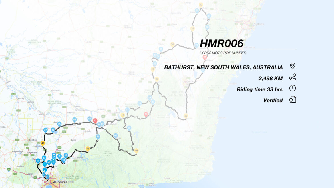
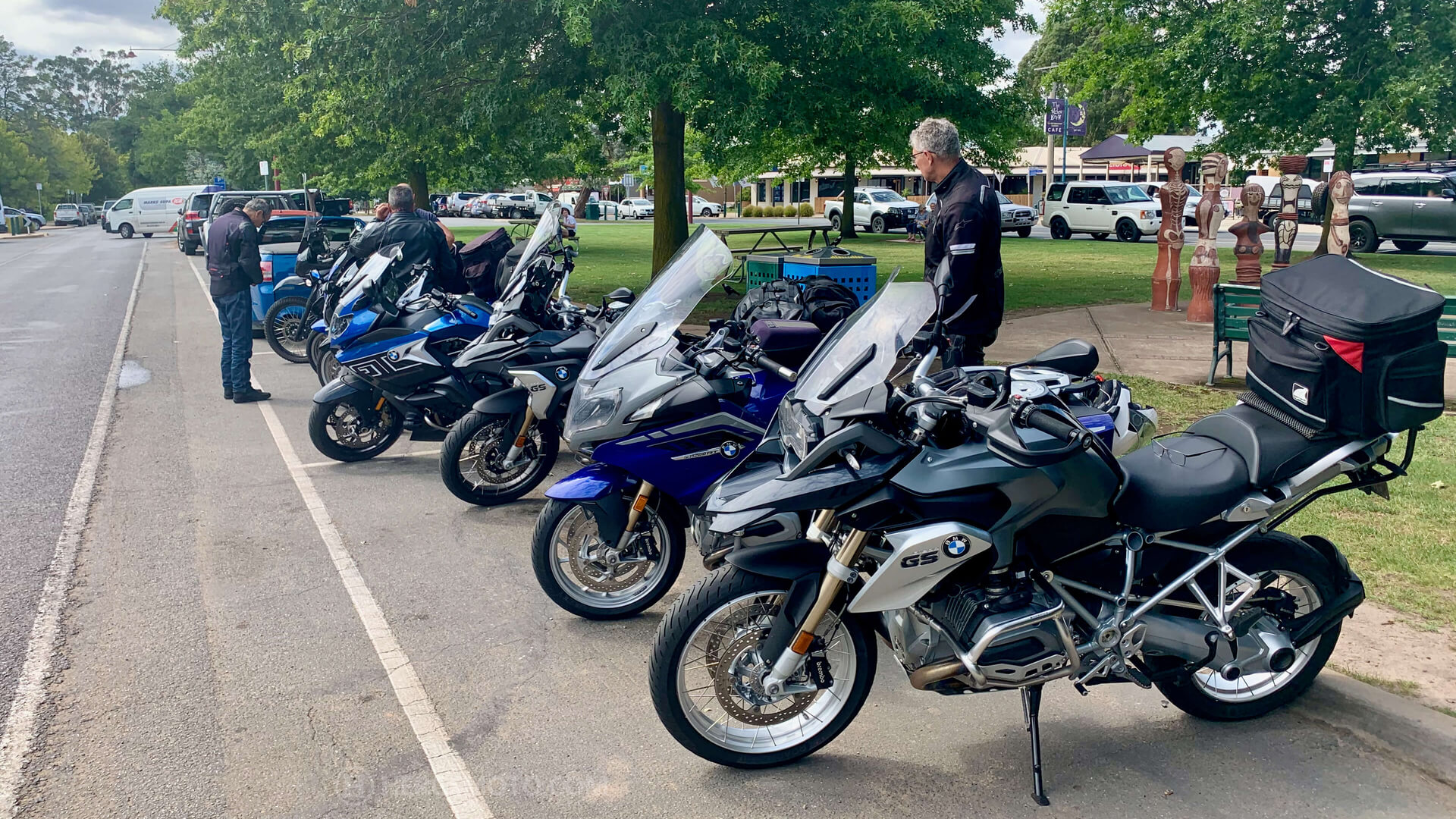
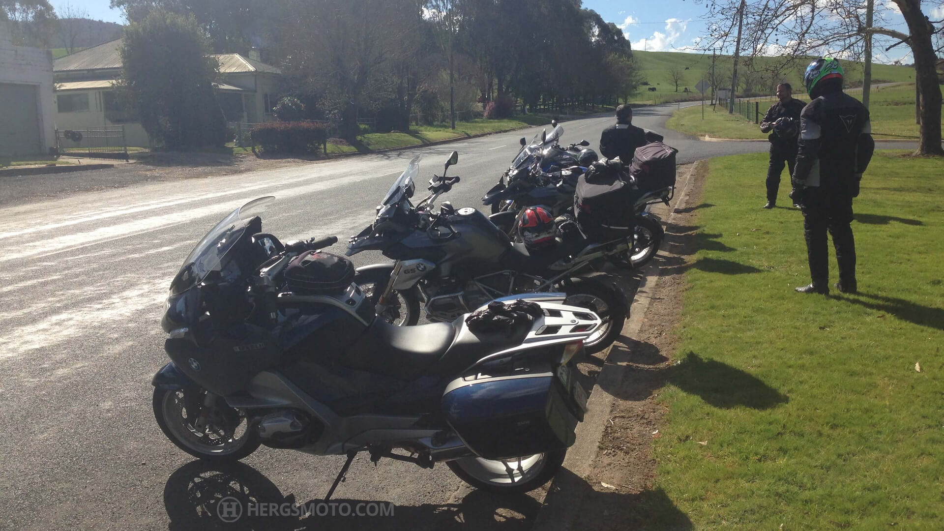
The ride was over 5 days. Just under 2,500 km in length and took in some of what I consider to be some of Australia’s best motorcycling roads.
WHERE TO?
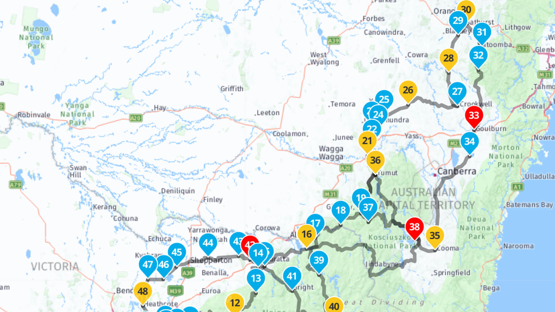
An online map of the route may be found here: https://www.myrouteapp.com/en/social/route/3944778?mode=share
DAY 1 – MELBOURNE TO TUMUT
We started off at 0730 from the BP Service Station outbound on the Calder Highway at Calder Park. From there, the Bulla-Diggers Rest Road led us onto the Lancefield Road at Sunbury, which in turn led us to the right hand turn onto Bolinda-Darraweit Guim Road.
This road traverses the plains until it winds down into the valley at the hamlet of Darraweit Guim (point 4 on the map below). Turn right onto Romsey Road and head to Wallan on this rather entertaining stretch of road, which twists its way through the hills and trees to Wallan.
Once at Wallan, we rode through town and onto Merriang Road, where we turned left towards Heathcote Junction (point 5). This road basically parallels the Hume Freeway following the ridge lines until you arrive at Broadford (point 8).
The swervery commences…
…and the serious fun begins. At Broadford, we turn right onto the Strath Creek Road (C382). This road, which passes by the State Motorcycle Racing Centre, sweeps its meandering but sometimes bumpy way through the forest until you get to the Murchison Gap, where the road tightens up severely into a 2 km section of well paved, tight turns… which catches some riders out, as evidenced by the scrape marks and bike debris which is sporadically scattered by the side of the road!
After the tight stuff, the road opens up and after about 5 km, the small hamlet of Strath Creek is reached. The pub here was a very pleasant place to refresh oneself during the ride, but it has been closed for a few years now, so we will continue past it, and take the first right turn onto Broadford Flowerdale Road – which is what the C382 is now named. This is a seriously good road – great lines of sight through sweeper after sweeper after sweeper – so good that one that may inadvertently indulge in a spot of throttle position inattention – heavens forbid!
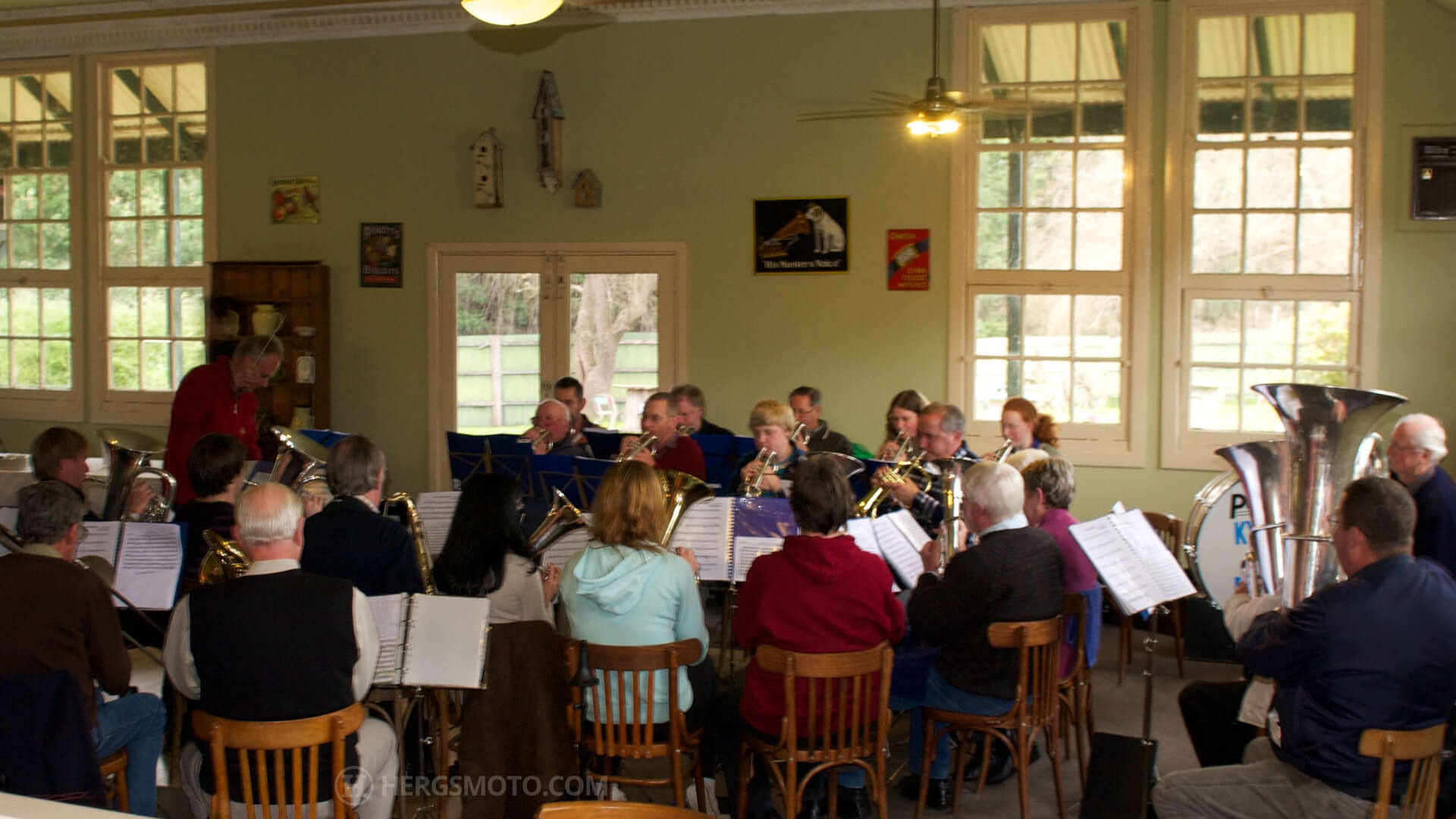
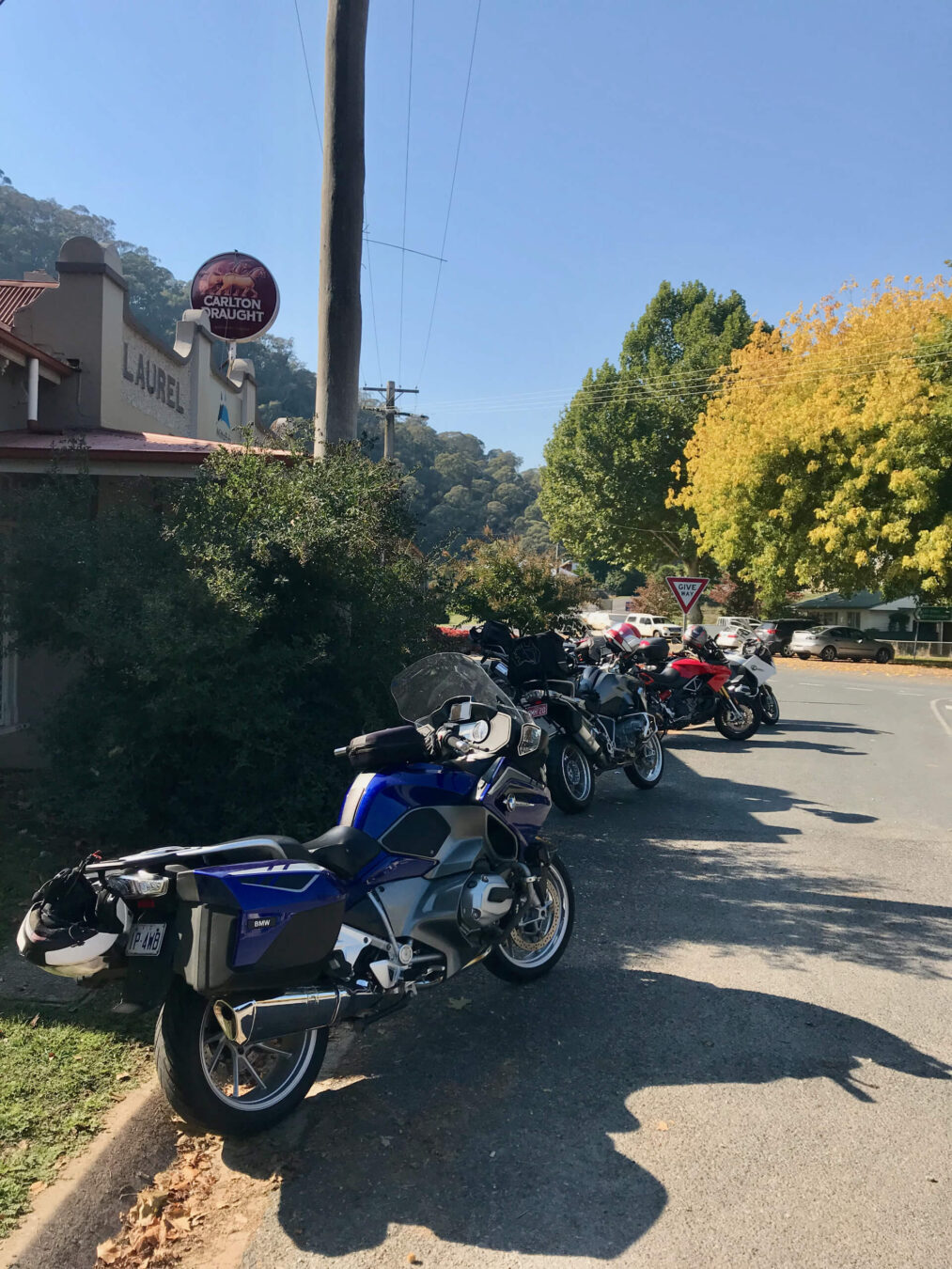
Once you reach Flowerdale – you are confronted by a T-intersection. To the right is the Flowerdale pub, which was open providing very good food and drink and sometimes some interesting afternoon entertainment. In one instance, a most tuneful brass band regaled us!
In this case, we turn left towards Yea on the Whittlesea-Yea Road. Another delightful road, which climbs through the forest in a succession of high speed sweepers until you commence the descent onto the Goulburn Valley and Yea, where a km or so of signposted 60 km/h corners invite you to scrub the edges of your tyres.
We did not stop at Yea, but continued onto Mansfield via the Highway. Cruise control is rather useful on this particular stretch of road, as it tends to be policed somewhat assiduously…..
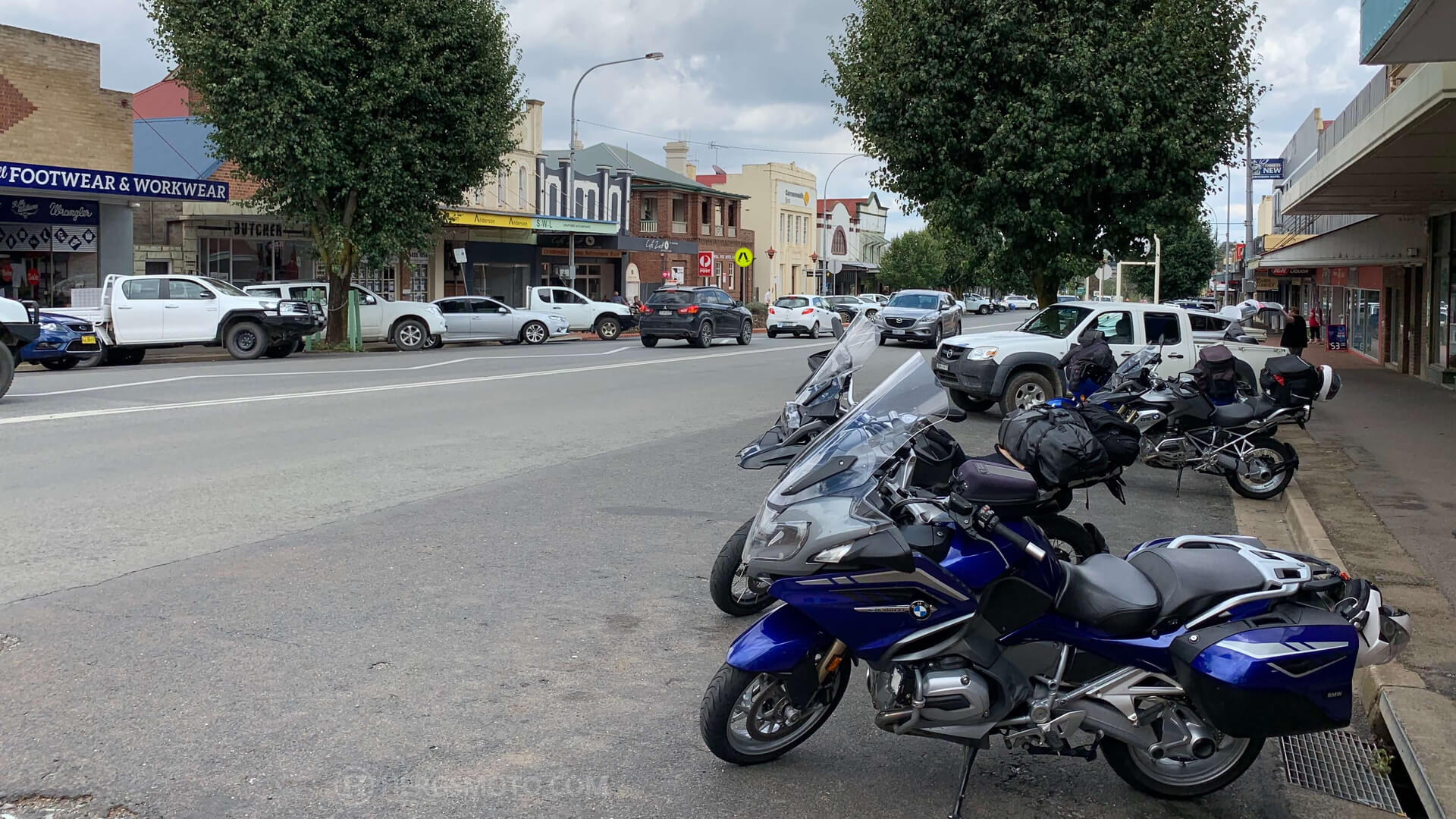
We stopped for fuel and coffee at Mansfield after a couple of hours of riding. There is an assortment of cafes, but we tend to stop at the Mansfield Bakery which provides both adequate coffee and sustenance.
Bittersweet
So onto the Mansfield-Whitfield Road. This road has always been a jewel in the crown of Australian motorcycling. 62 km of tight corners, wide sweepers and some spectacular views – but some of the gloss has been taken from it in recent times.
The reason for this lamentable state of affairs is that the major part of the road – and the best part of it from Tolmie onwards – is now speed limited to 80 km/h. This is ok when the going is full of 25 to 45 km/h corners and there are quite a few of them… but it is somewhat soul destroying to continuously keep a look out for not only errant wildlife, but also Highway Patrol units. Sadly, I foresee much revenue being raised, and many a licence shredded on this road.
Enough of the sad stuff. The first part of this video clip shows what a great road it is. It also includes vision of two other noteworthy roads.
So, we head down the mountains to Whitfield (point 13) and then travel up to the King Valley through very fecund wine country to Milawa, Everton (points 14 and 15) and Beechworth. From Beechworth, we proceed through Yackandandah for our fuel and lunch stop in Tallangatta.
More swervery!
After suitably refreshing both motorcycle and self, travel on the Murray Valley Highway eastwards until we get to the intersection of the Granya Gap Road (C546) and turn left onto it towards Granya at point 17. What follows is a blissful road, lots of tight corners to really get your tyres well scrubbed; herewith some incriminating evidence.
At the end of the Granya Gap Road, we turned right onto the River Road – for 70 km of sweepers and river views, crossing the Murray River into NSW at Jingelic (point 18).
The last leg of Day 1
Heading north on the Jingelic Road takes us over hill, dale and forest to Tumbarumba (point 19)… I remember that this road had a derestricted speed limit sign on it up until 10 years ago! Tumbarumba also makes a good overnight stop, with comfortable motels and tremendous meals at the Tumbarumba Hotel. The road continues to sweep through the hills and forests towards Batlow and into Tumut (point 20), where we spent the night at the The Elms Motor Inn. This establishment is very clean, comfortable, reasonably priced with great staff.
The Woolpack Hotel in Tumut is our go to place for dinner. It offers reasonably priced and well prepared food with friendly service.
So endeth Day 1 after 629 km.
DAY 2 – TUMUT TO GOULBURN
Day 2 dawned cool and sunny, so we headed along Gocup Road to Gundagai.
Whoops!
Gocup Road is an absolute pleasure to ride. A combination of astounding scenery as you ride on well surfaced sweeping bends could lead you astray, as indeed it did us – leading to some inadvertent exuberance on some of those bends. Luckily… the excellent sight lines through those same bends enabled us to spot the Highway Patrol car just before he saw us!
Breakfast in Gundagai is usually at the Gundagai Bakery. Next time in town, we plan to sample the delights of Hope’s Place as anecdotal reports advise that it is very good.
From Gundagai, we rode along the Hume Freeway (BORING!) for about 16 km and took the Coolac exit to the left – riding through the small locale of Coolac. Keep going along Muttama Road which is a surprise, having a good amount of swervery to keep one entertained, until we turned off right onto the Old Gundagai Road. After 5 or so km, turn right onto Rosehill Road. This road is narrow and rather bumpy in places, but is well worth it, as you twist your way through the valley to its intersection with Jugiong Road (point 24), where one turns left and travels north to Harden.
It is a quick trip through Harden(point 25) , via Cunningar to Boorawa (point 26), which is a very suitable place to refuel both motorcycle and one’s self. After a quick stop, proceed along the Rugby Road, which is about 60 or so km of tight corners, sweeping bends, climbs and descents through pastureland and bush until you arrive in Crookwell (point 27). Crookwell itself is a well maintained town, and apart from offering an acceptable standard of coffee and food, it is the home of Lindner Socks. These are socks of serious high quality, capable of keeping one’s feet warm for many a year which I speak from experience!
Now from Crookwell, we head northwards on the Binda Road towards Tuena, Trunkey Creek and eventually Bathurst.
This road ranks amongst my favourite roads. Here is a link to some video that may, partly explain why I hold it in such esteem.
The General Store in Tuena is worth stopping at for a drink and a snack. The Parsons Family have been running the store for over 130 years, and it is a very pleasant place to take a break.
In addition, the store has helped numerous motorcyclists over the years, including a personal experience where a member of our group came to grief on a tight uphill left hander just out of town. The shop keeper could not do enough to help, including letting us use her phone to call for help for both the bike and the rider. There is no mobile service in town, so this act of kindness was very much appreciated!
Do be a bit careful as you come out of town, just after you pass the 100 km/h speed limit sign – the aforementioned corner is not signposted, and it is easy to let one’s natural exuberance take over and be caught out. You climb a succession of tight corners for about a kilometre or so, then come up on top of the plateau, with a sweepers and open road to take you into Bathurst via Trunkey Creek and Georges Heights.
Once in Bathurst, we stopped for lunch and then [how could we not!] did a lap of the infamous track. Due to camera battery issues, I did not get any footage of this – but, for a laugh here is a clip of a lap that I did with a group of fellow nutters who rode their old scooters to the Gold Coast for a scooter rally…. https://youtu.be/y3IvlwqZetE
From Bathurst, we headed south towards Oberon staying on the Abercrombie Road towards Taralga and thence to Goulburn.
The Abercrombie Road is another of my favourites. You are riding along a mountain plain for most of it, with some spectacular views across the hills and valleys. The road surface is generally OK. There is a rather tight downhill section – which was thankfully been re engineered a couple of years ago – to the narrow bridge crossing the Abercrombie River and a commensurately tight climb uphill – on a mediocre road surface, until you climb out of the Abercrombie River Valley and proceed south to Taralga.
Taralga itself is a pleasant enough town with the Taralga Hotel being a place with a great menu and very comfortable accomodation.
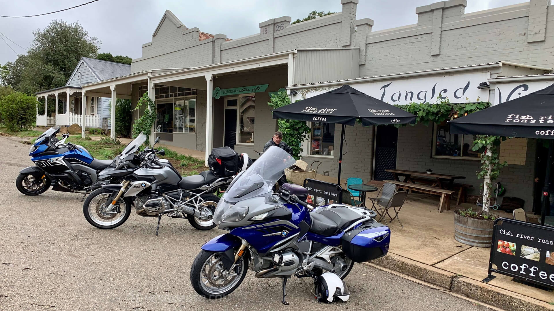
The Ploughman’s Cafe serves excellent food, along with very drinkable coffee. Sadly, another esteemed Taralga Cafe – the Tangled Vine – has been shut since a fire in August 2020. 🙁
Taralga to Goulburn is 44 km of farmlands, some forest and a generally good ride. Please note that the NSW Police Service has its Academy and Driver Training School located at Goulburn, so do not be too surprised if you encounter a gaggle of police vehicles on this road.
We overnighted in Goulburn at the Goulburn Central Motor Lodge.
This motel has a great location, being in the centre of the Goulburn Main Street. The rooms are basic, but clean and comfortable. A good tip is to book directly with the motel, rather than use online booking services such as booking.com or wotif.com. You’ll save about 20% by doing this!
We had dinner at the venerable Paragon Cafe that night.
This cafe is simply amazing and serves as a time capsule showcasing some of the more traditional values of the hospitality industry. It has been around for 80 years… and it is shown in the decor of the cafe, along with the excellent customer service that is displayed once you walk into the mirrored dining room. The menu is huge, as are the servings of delicious food that are served to you! Make sure that you are hungry when you visit.
DAY 3 – GOULBURN TO CORRYONG
The ride south from Goulburn is probably more scenic than exciting, as it winds its way through pastoral areas and though the towns of Tarago and Queanbeyan, until we join the Monaro Highway, just north of Royalla, southbound for Cooma.
We stop at Cooma for breakfast and to fuel up before setting off on one of the highlights of the trip, the Snowy Mountains Highway.
The 180 km from Cooma to Talbingo is simply a delight.
Well surfaced roads, sweepers that can inadvertently be taken at adventurous speeds, some sections of tight twisty corners – especially the downhill run to Talbingo, coupled with spectacular Alpine views (which can be a distraction….), make it a favourite road upon which to journey.
The first 4 minutes of this clip https://www.youtube.com/watch?v=-D432CvF1xk&t=9s will give you an idea of what it is like to ride. It is usually lightly trafficked, which adds to the attraction. We decided to pull into Adaminaby to get some water into us as I had already drained my Camelbak due to the hot weather. It was 41 degrees in Tumut, where we stopped for lunch!
After lunching at Tumut, we continued on the road to Tumbarumba, where another drink stop was in order. Instead of following our usual route to the Murray River at Jingelic, we turned left at Tumbarumba and headed across the hills along the Tooma Road to Maragle (Point 37) and to Tooma.
This road is very good as well, though it does have some patchy road surfaces to navigate. As we scooted along the hills, the panoramic views allowed us to see various storm cells unloading their rainy payloads upon the countryside. We managed to avoid them… more by luck than judgement.
The Tooma Pub is a favoured place for motorcyclists to congregate. Great food and one is made very welcome by the staff.
We arrived in Corryong for the night just in time to miss being drenched. As we checked into the Corryong Country Inn, the thunder cracked and the rain came a’tumbling down! The Inn is a most comfortable place in which to stay, and their Riley’s Restaurant did a good job on feeding us that night. On previous trips to this town, we have stayed at the Mountain View Motel and dined at the Corryong Hotel, places which are also recommended as places to sleep and eat. One note though; The BP in town shuts on Saturday afternoon at about 1:00 PM and I do not think that the other servo in town stays open much longer, so you may have to wait until they open on Sunday morning until you can refuel. Luckily, we had plenty of fuel left as we had fuelled up at Tumbarumba – just in case.
DAY 4 – CORRYONG TO WANGARRATTA
The next morning, we left at about 0700 and rode along the Murray Valley Highway to Tallangatta. If one must travel on a highway, then the Murray Valley Highway is a great choice, as it winds its way over hill and forest to Tallangatta, where we refuelled the bikes and breakfasted at the Tallangatta Bakery… yet again! From there, we retraced our way back east on the Murray Valley Highway to the C543 turnoff – where the fun really began!
The C543 heads south to Mitta Mitta, Omeo and thence Bairnsdale. It starts off pleasantly enough, sweeping through farmland and pasture until you arrive at Mitta Mitta, where the General Store serves both fuel and quite delicious consumables. The Mitta Pub is just across the road, and has acquired quite a reputation as a foodie pub.
Enough of the culinary attractions. The highlight of Mitta Mitta is the road leading out of it! Why? Because it is 108km – yes, 108 KM of twisting, well surfaced roads, with the majority of the corners signposted at less than 70 km/h it appears… draw your own conclusions.
To aid you in your estimation, this clip will give you an idea of its attraction…
https://youtu.be/t-GZatI-Cl0
The C543 twists, turns and generally does not stop twisting and turning until you are about 10 km out of Omeo. A couple of notes about this road, though:
- It is very easy to succumb to the “red mist”, where you just want to keep going faster and faster around the succession of tight corners. That, in itself, is not necessarily a bad thing. Just remember that you are in a very remote locality, with help being a long time away, if a mishap should occur. There is little or no mobile phone coverage down the road, so a PLB is a good thing to carry, especially if you are riding solo.
- The road surface can change! One fine, rather hot trip, Sean and I charged down the Mitta Mitta Road …and after a few kms, my motorcycle seemed to be handling as if it had flat tyres! The Tyre Pressure Monitoring System did not show any errors, so I pulled over to check things out. Lo and behold, the road surface was very spongy, with tar leaching to the surface. Mmmmm the road must be surfaced with an Alpine asphalt mix – which means that it becomes very soft in temperatures much above 30 degrees C – and therefore usually has a deleterious effect on the handling of your motorcycle – especially if one is engaged in a bout of …ahem, “spirited riding”!
Moving on, the Blue Duck at Anglers Rest is another excellent place to stop and have a meal.
So, once in Omeo, we fuelled up and set off onto the Great Alpine Road. Much has been written about this road, so I will not go into too much detail here, except to lament that a lot of it has been restricted to 80 km/h. BOO! The final 28km or so down the mountain from Mt. Hotham to Harrietville is an absolute delight, especially if one is not held up by slow moving convoys of cars.
From Harrietville, we followed the scenic, if somewhat busy, Snow Road to Wangarratta, via Smoko, Bright and Myrtleford, where we overnighted at the Park Motel.
DAY 5 – RETURN HOME.
There are quite a few ways to return to Melbourne from Wangarrata, ranging from a quick blast down the Hume Freeway, to carving up the Whitfield Road back to Mansfield.
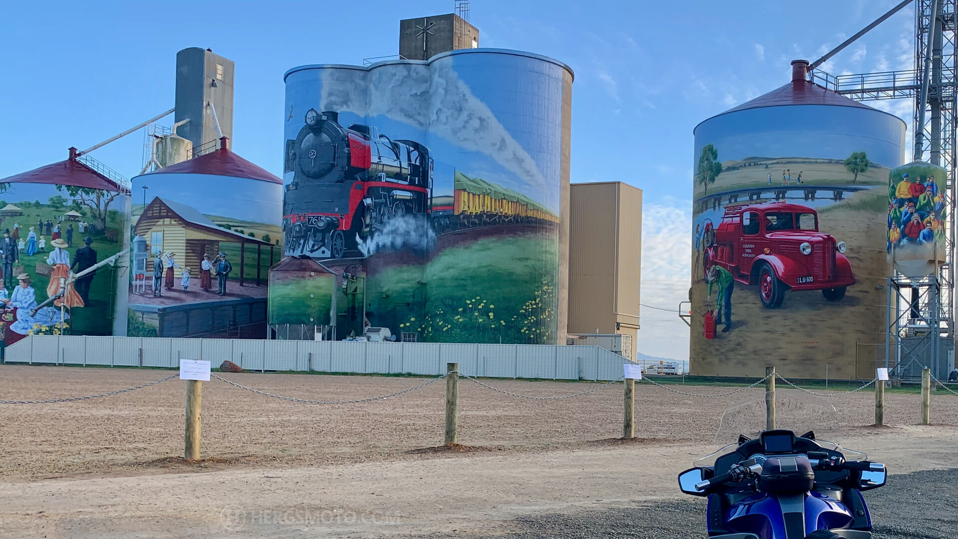
I decided that a quick run through some back roads would be in order, so we headed north and took in the twisty roads of the Warby Hills, which are just outside of Wangaratta. From there, we rode through Devenish (which has excellent silo art), through Dookie onto Shepparton, to Tatura and then along the C356, which skirts alongside the Waranga Basin, onto Rushworth where a very welcome coffee was had at the Bakery.
On we rode to Colbinabbin, a village that has two attractions – the spectacular silo art display and the Colbinabbin Country Hotel, which has established a reputation for quality, delicious food and great service.
A couple of kilometres past Colbinabbin is the turn off for the Rochester-Heathcote Road, (C347) which takes you through a rolling landscape of vineyards and pastures until you join the Northern Highway, which leads you into Heathcote.
Heathcote is good stop at which to refuel both body and bike again and from there we travelled south east on the Northern Highway to the hamlet of Tooborac, which has the Tooborac Pub, with its craft beers – and beer garden – and its Tooborac Pies… which are simply scrumptious!
What? Riding rather than eating? Again? OK, at Tooborac, we turn right onto the Tooborac-Lancefield Road. This is 29 km of sweepers through a volcanic landscape of hills, rocks and trees. The road surface is questionable at times, so ride to the conditions.
We arrived at Lancefield, where we fuelled up for the last time on this trip. After this it was a fairly innocuous trip down a heavily policed Lancefield Road, through to Sunbury, the Calder Freeway and home.
CONCLUSION
Almost 2,500 km of riding over a variety of roads, ranging from alpine to arid farmland. No speeding tickets – more by luck than judgement – riding through towns and places that differed not only in their size and location but also in the welcome that we received. If you like to watch, then here is a link to a summary video of this ride – https://youtu.be/pcbMpBX2F64
I cannot wait to do it again.
#makelifearide